Book of Shiloh History and People
- LRA 0299
- Item
- June 5, 2007
Part of LRA Photograph Collection
Names of people in cemetery and history of group.
13 results with digital objects Show results with digital objects
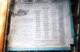
Book of Shiloh History and People
Part of LRA Photograph Collection
Names of people in cemetery and history of group.
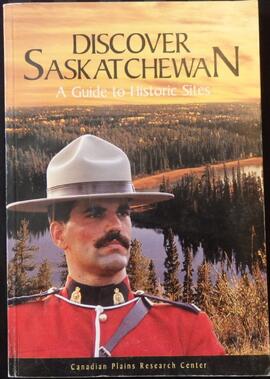
Discover Saskatchewan: A Guide to Historic Sites
Part of Book Collection
A 206-page paperback book with 12 pages of colour plates at the end. Contains brief description and the history of many historic sites in Saskatchewan. Chapter 3: Horizon Country includes write-ups about Indian Head (the federal Experimental Farm and the Bell Farm) as well as Qu'Appelle, Lebret and Fort Qu'Appelle.
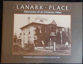
Lanark Place: Memories of an Ontarian West
Part of Book Collection
Small paperback book containing information about the Motherwell Homestead with black and white photos and drawings for reference.

Monument at Shiloh Baptist Church
Part of LRA Photograph Collection
Granite pedestal with a history an list of "The Shiloh Peoples" on top. The front of the pedestal reads "Donated in the year 2002 by the Shiloh Baptist Church and Cemetery Restoration Society of Edmonton Alberta"

Monument at Shiloh Baptist Church
Part of LRA Photograph Collection
Close-up of plaque on top of pedestal citing the history and names of "The Shiloh People"
Part of LRA Photograph Collection
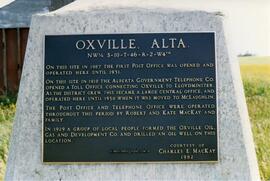
Plaque for site of the first Oxville post office 1907-1931.
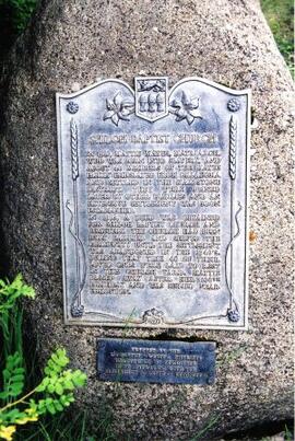
Plaque at Shiloh Baptist Church
Part of LRA Photograph Collection
Plaque mounted on a rock with the history of Shiloh Baptist Church & Settlement
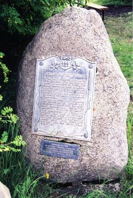
Plaque at Shiloh Baptist Church
Part of LRA Photograph Collection
Plaque mounted on a rock with history of the Shiloh Baptist Church & Settlement
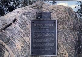
Plaque marking the Kenderdine Homestead
Part of LRA Photograph Collection
Plaque for homestead - Saskatchewan homecoming 1971

Part of LRA Photograph Collection
Photo of a plaque mounted on a boulder. The plaque was erected for Saskatchewan Homecoming ' 71.
Part of LRA Photograph Collection
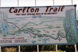
Sign depicting a map of the Carlton Trail from Upper Fort Garry, Manitoba to Fort Edmonton, Northwest Territories.
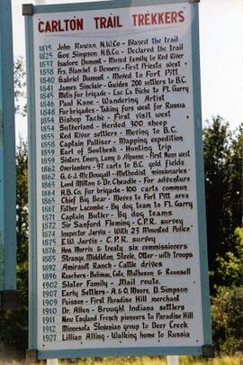
Sign of Carlton Trail Trekkers
Part of LRA Photograph Collection
View of a sign listing prominent groups and people to use the Carlton Trail 1815-1927.
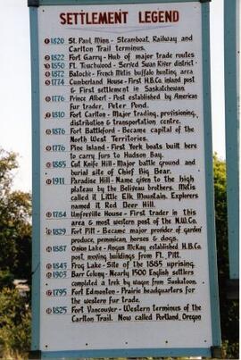
Sign of Settlement Legend for the Carlton Trail
Part of LRA Photograph Collection
A sign depicting the timeline of settlement along the Carlton trail 1774-1911.