- WOK 10-99
- Item
- 1960
Part of W.O. Kupsch fonds
Typical house of Reykjavik. Note siding of corrugated iron used in this country which lacks timber. August 1, 1960.
1974 results directly related Exclude narrower terms
Part of W.O. Kupsch fonds
Typical house of Reykjavik. Note siding of corrugated iron used in this country which lacks timber. August 1, 1960.
Typical members of the Permian Eurydesma fauna
Part of W.O. Kupsch fonds
Typical members of the Permian Eurydesma fauna (Agar 1963, p. 290).
Typical profiles of the continental shelf
Part of W.O. Kupsch fonds
Typical profiles of the continental shelf. The vertical scale is greatly exaggerated. This serves to show the variation between a smooth graded slope (Sec. A) and the highly irregular shelf off a glaciated area (Sec. G), 1960, p. 71.
Unconformable contact - Lake Minnewanka near Banff, Alberta
Part of W.O. Kupsch fonds
Unconformable contact between permo-pennsylvanian Rocky Mountain quartzite at left and Triassic Spray River formation, dark phosphatic shale at right. Lake Minnewanka near Banff, Alberta
Unconformable contact between Whitemud Formation and Frenchman Formation
Part of W.O. Kupsch fonds
Unconformable contact between lower, sandy member of Whitemud Formation below and Frenchman sands above. Note clay pebbles forming a basal conglomerate in the Fenchmen sands. No quartzite pebbles were found in place as mentioned by Kupsch, 1956, p. 20-21. May, 1964.
Unconformable contact between Whitemud Formation and Frenchman Formation
Part of W.O. Kupsch fonds
Unconformable contact between upper white member of Whitemud Formation below and purplish clays of Frenchman Formation (Battle facies) above. Ravenscrag Butte, Saskatchewan. May 1964.
Unconformity between marine gravels
Part of W.O. Kupsch fonds
Unconformity between marine gravels wit Mytilus (a pelecypod) over ice contact stratified drift. Boseville pit near Ottawa.
Uncontrolled disintegration moraine
Part of W.O. Kupsch fonds
Uncontrolled disintegration moraine with "doughnuts" emphasized by aspen ring "bluffs". East of Saskatoon, flight to Winnipeg.
Uncontrolled disintegration moraine - NW of Saskatoon
Part of W.O. Kupsch fonds
Uncontrolled disintegration moraine (rimmed kettles) from air. Northwest of Saskatoon on flight to Edmonton.
Uncontrolled disintegration pattern with well-developed "doughtnut"
Part of W.O. Kupsch fonds
Uncontrolled disintegration pattern with well-developed "doughtnut". East of Saskatoon, flight to Winnipeg.
Uncovering a mammoth tusk in preparation of a plaster block
Part of W.O. Kupsch fonds
Uncovering a mammoth tusk in preparation of a plaster block in the field: (a) discovery, (b) outlining the block, (c) application of shellack, (d) first plaster strips over wet newspaper, (e) reinforcing block, (f) plaster strips covering side of block. (Stirton, 1959, p. 35).
Unglaciated part of Wood Mountains where no erratics found
Part of W.O. Kupsch fonds
Unglaciated part of Wood Mountains where no erratics have been found. Looking west along Highway 2, south of Rock Glen. Sunday, October 2, 1960.
Unglaciated plains area near Bellefourche, S.D.
Part of W.O. Kupsch fonds
Unglaciated plains area near Bellefourche, S.D.
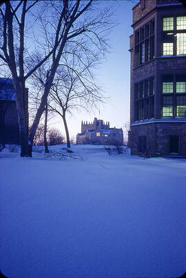
University of Saskatchewan campus
Part of L.G. Saunders fonds
A University of Saskatchewan building is seen in the distance at dusk during the winter.
University of Saskatchewan flower bed
Part of L.G. Saunders fonds
A University of Saskatchewan flower bed is seen at the north end of the Quad with the Chemistry building seen in the distance on a clear spring day.